The Scafell Pike Ascent: From Wastwater to the Roof of England

Tackling England’s highest peak via the classic, relentless direct line from Wasdale Head, rising through green lower gills into the massive, boulder-strewn alpine wilderness of the high fells.


“Rising from the tranquil shores of Wastwater to stand on the raw, rocky summit plateau of England’s highest ground.”


Leaving Wasdale & Lingmell Gill

Setting out from the valley floor near the head of Wastwater, the track wastes no time easing you into the climb. The trail runs alongside the cascading waters of Lingmell Gill, framed by ancient twisted trees and sweeping views looking back toward the dramatic silhouette of the lake.

The early section climbs steadily over well-made stone pitched paths, crossing mountain becks as the valley quickly drops away below.


The Push Up Brown Tongue & The Scree

Crossing the stream, the gradient steepens significantly as you push up the spine of Brown Tongue. Here, the landscape transitions from green bracken slopes to raw mountain terrain. The massive, towering crags of Scafell and the Mickledore ridge begin to dominate the skyline.

The path underfoot turns from pitched rock to rough scree and loose gravel, with every turn revealing broader, sweeping panoramas of the Western Fells.


Crossing the High Boulder Field

Higher up, the distinct trail dissolves into the legendary Scafell Pike boulder field. Navigating this vast expanse of shattered volcanic rock requires careful footwork.

The clouds shift rapidly across the high ridge, creating dramatic pockets of light and deep shadow across the rugged mountain bowl.


England’s Highest Point

Reaching the massive summit plateau at 978 metres, you arrive at the iconic stone shelter and trig pillar marking the roof of England. On a day with shifting cloud, the views across the Lake District fells are staggering—stretching over Great Gable, the Scafell ridge, and all the way back down to the gleaming surface of Wastwater far below.


Behind the Images

  • Location: Scafell Pike via Lingmell Gill and Brown Tongue from Wasdale Campsite.
  • Conditions: Dramatic mountain skies with high summer contrast—crisp blue overhead, brooding cloud shelves rolling across neighbouring fells, and sharp shadows racing over the crags.
  • Focus: Juxtaposing the vibrant, winding beck and fell-grass approaches with the sheer, unforgiving scree fields and colossal boulder plateaus of the upper summit massif.
  • Note: Wide panoramic framings look back over Wastwater to capture the vast verticality of the ascent, while tight portrait crops showcase hikers navigating the rugged boulder fields.

Walk Summary — Scafell Pike from Wasdale

  • Distance: ~8.5 km / 5.3 miles
  • Elevation Gain: ~915 m / 3,000 ft
  • Duration: 4 – 5 hours
  • Difficulty: Strenuous (A steep, unrelenting ascent over pitched stone steps, shifting scree, and large boulder fields near the summit)
  • Start Point: Wasdale Head / Wasdale Campsite
  • Route Type: Out & Back / Lollipop


Join the Conversation!

Did you take the classic Brown Tongue line up from Wasdale, or have you braved the corridor route from Borrowdale? Drop your favourite way up Scafell Pike in the comments below! 👇


Industry, Slate, and Sky: The Old Man of Coniston & Goats Water Loop


“Ascending through the industrial scars of ancient copper and slate mines straight to the panoramic, windswept ridge of one of the Lake District’s most iconic peaks.”


The Track Up Walna Scar

The route sets off along the broad, gravelled track of Walna Scar Road. In the morning sun, the lower slopes are vibrant and green, with early viewpoints looking back across rolling fields toward the blue waters of Coniston Water stretching out in the distance.

As you work your way higher, the easy track begins to narrow into the open fell. Ahead, the massive, craggy wall of the Coniston range comes into sharp focus, cutting across a deep blue sky.


Climbing the Crags & Scree

Leaving the main track, the path turns directly toward the heart of the fell, carving through boulder-strewn grass and steepening quickly. Massive gritstone and slate boulders line the trail, giving a raw, alpine character to the climb as you gain height above the valley floor.

Reaching Goats Water

Breaching the high basin, the trail brings you face-to-face with Goats Water. Tucked neatly inside a massive, dark rock cirque directly beneath the summit cliffs, the mountain tarn looks striking in the bright sunlight. The stillness of the deep water offers a great natural pitstop before taking on the steep zigzags to the top.

The Summit Ridge & High Vistas

The final push from Goat’s Water is relentless, following tight stone-pitched switchbacks that rapidly gain elevation. Looking out across the surrounding ridges, the views open up dramatically. Dramatic drop-offs, scree gullies, and neighbouring Wainwright fells stretch out endlessly under the summer sun.

Standing up on the high ridge, you get an incredible 360-degree vantage point across the entire Lake District landscape—from the distant mountain peaks right down to the valley lakes and coastal plains.


Behind the Images

  • Location: Old Man of Coniston, Low Water, and the historic slate/copper mining quarries.
  • Conditions: Sun-drenched, clear blue skies with crisp, high-altitude visibility stretching across the fells and out toward the coast.
  • Focus: Juxtaposing the open, grass-lined valley tracks with the steep, exposed rock faces, deep tarn waters, and massive slate scree slopes.
  • Note: The wide panoramic framing across Goats Water and the summit ridges highlights the sheer height gained on this climb, giving a brilliant sense of scale against the Lakeland landscape.

Walk Summary — Old Man of Coniston & Low Water Loop

  • Distance: ~7.5 km / 4.6 miles
  • Elevation Gain: ~576m / 1,890 ft
  • Duration: 2.5 – 3.5 hours
  • Difficulty: Moderate to Strenuous (A steady, continuous climb over rocky, slate-heavy paths with steep zigzags up to the high ridge)
  • Start Point: Walna Scar Road Car Park / Coniston
  • Route Type: Circular

📥 Download the Route Map & GPX

Ready to take on this Lake District classic and explore the high tarns and slate ridges for yourself? Download the verified GPX map data directly to your device here:

👉 [Download Old Man of Coniston & Goats Water Loop GPX – Hiiker](https://hiiker.app/hikes/users/old-man-of-coniston-and-low-water-loop–1933022760)
follow link and click on download


Join the Conversation! Is the Old Man of Coniston your top Lake District fell, or do you prefer the quieter routes further north? Drop your favorite Lakeland trek in the comments below! 👇

Moss and Millstones: The Padley Gorge & Over Owler Tor Circular


“Moving from the deep, mossy dampness of an ancient oak gorge straight up onto the brooding, windswept gritstone edges of the Peak.”


The Woodland Floor

Our journey began beneath the dense, shifting canopy of Padley Gorge. After the relentless heat of recent walks, stepping into the damp, sunken microclimate of the oak woodland felt like entering an entirely different world. The air here hangs heavy with the scent of wet earth and decaying wood, trapped by a thick ceiling of vibrant green leaves.

Following the course of the trickling stream, the ground is an organic maze of exposed, twisted tree roots and ancient, moss-slicked boulders. Everywhere you look, nature is reclaiming the landscape; fallen trunks are completely blanketed in a rich velvet of moss. The diffused light filtering through the overcast sky perfectly accentuates the deep, moody tones of the forest.


Tracing Ancient Dry Stone Walls

Deep within the woodland, the trail follows a spectacular, historic dry stone wall. Completely overtaken by time, every single gritstone block is clad in a thick coat of emerald moss and bracketed by a dense sea of ferns. The structural alignment of the wall provides a sharp, linear contrast to the beautifully chaotic growth of the surrounding birch and oak trees.

As the path begins to climb steadily out of the gorge, the woodland thins out, transitioning into old quarry tracks. Walking beneath the massive, twisting branches of ancient, weather-beaten trees, you get a palpable sense of the history embedded in this hillside, where nature and old industry have seamlessly fused together.


Breaking Onto the High Edges

Leaving the shelter of the canopy behind, the route breaks violently open onto the high, windswept expanse of Lawrencefield and Over Owler Tor. The transition is immense. In a matter of steps, the claustrophobic greens of the gorge are replaced by sweeping, panoramic vistas across a vast tree clad valley, framed by dramatic, dark gritstone edge-lines cutting into a heavy, threatening cloud layer.

Up on these exposed moors, the landscape feels raw and heavily weathered. The trail guides you past the striking, isolated gritstone stack of Mother Cap, standing proud against the brooding sky like a monolithic sentinel. Nearby, discarded historical relics lie hidden in the grass—including a massive, perfectly circular, moss-ringed millstone abandoned on the hillside, a quiet monument to the Peak’s ancient stone-cutting heritage.


Behind the Images

  • Location: Padley Gorge, Lawrencefield Quarry, Mother Cap, and Over Owler Tor.
  • Conditions: Moody, overcast skies with low-hanging, heavy cloud layers creating rich contrast, deep shadows, and beautifully diffused light over the oak canopies and open heather moors.
  • Focus: Juxtaposing the ancient, moss-laden, twisting organic chaos of Padley’s woodland floor with the stark, weathered, geometric silhouettes of the high gritstone edges and discarded relics of the historic stone-cutting quarries.
  • Note: The portrait framing of Mother Cap emphasizes its dramatic height, capturing the towering stack cutting straight into the brooding cloud shelf while a hiker provides a sharp sense of scale against the stone.

Walk Summary — Padley Gorge & Over Owler Tor Circular

  • Distance: 7.17 km / 4.4 miles
  • Elevation Gain: ~255m
  • Duration: 2 – 2.5 hours
  • Difficulty: Easy to Moderate (A steady, gentle incline up from the gorge followed by a short, rocky scramble across the gritstone edges)
  • Start Point: Padley Gorge / Longshaw Estate
  • Route Type: Circular

📥 Download the Route Map & GPX

Want to track this misty woodland and gritstone edge-line loop yourself? Download the verified data directly to your device here:


Join the Conversation!

Leave a Comment Below!Which side of this walk wins for you: the deep, mossy tracks of the gorge, or the wide-open views from the gritstone edges? Let me know in the comments below! 👇


Hiking Trails // The Field Guides: Kinder Low & Downfall Circular

“Tackling this legendary plateau in 30°C heat completely changes the game. An early 06:50 AM alpine start was the secret to success.”


Kinder Scout is a legendary Peak District monolith, but tackling it during a heatwave completely changes the game. This 5.5-hour circular route takes you from the valley floor up onto the high western plateau, navigating the massive gritstone stacks of Kinder Low, tracking the classic edge-lines down to the iconic Kinder Downfall, and looping back down with spectacular open-vista valley views.

Tackling this trail requires respect at the best of times, but in 30°C heat, an early 06:50 AM alpine start was the secret to success—allowing us to climb the heavy elevation before the midday sun locked onto the plateau.


The Ascent from the Valley Floor

Setting off in the cool early morning air, the trail begins on a beautiful, historic stone-walled path. The low morning light cuts across the dry stone walls, guiding you steadily upward. The tree canopy breaks early on this route, making the early morning start crucial as you begin tackling the steep, paved gritstone steps that haul you up toward the edge of the plateau.

AM morning light.

High Plateau & Kinder Low Summit

As you summit the edge, the true scale of the Peak District breaks wide open. Tracking past spectacular rock formations, you arrive at the Kinder Low trig point (633m). The air up here is thin, dry, and during a heatwave, completely exposed. The contrast between the brilliant blue skies and the ancient, weathered gritstone stacks provides an almost desert-like atmosphere on a day like today.

Zero shade. pure exposure.

The Edge-Line to Kinder Downfall

From Kinder Low, the trail cuts north along the rugged plateau edge toward Kinder Downfall—the famous intersection where the river cuts deep into the plateau beds. In peak summer heat, the downfall shifts from a roaring waterfall to a quiet, striking gorge, showing off the raw geological layers of the gritstone shelf. The panoramic views stretching out across the reservoir below are immense, offering a massive sense of scale.

At the top of the downfall.

The Descent & The Valley Heat

Leaving the high edge behind, the trail descends back down toward the valley. By 11:30 AM, the heatwave conditions become fully apparent as the air locks down in the lower valleys. Navigating the final stretch of the loop back to the start point requires a steady pace, finishing up at 12:28 PM just as the peak afternoon heat takes hold.

Chasing the ridge line.

Behind the Images

  • Location: Kinder Low trig point, Kinder Downfall upper beds, and the western plateau edge-lines.
  • Conditions: Intense summer heatwave (30°C) with piercing, high-contrast sunlight and clear, burning blue skies over the stark gritstone shelves.
  • Focus: Contrasting the deep, shaded, stone-walled morning tracks with the raw, baking, desert-like exposure of the high plateau and the massive geological scale of the dry downfall gorge.
  • Note: The wide panorama shot over the reservoir was framed to emphasize the mirror-flat water reflecting the massive, sun-drenched scale of the looming Peak District ridges.

Walk Summary — Kinder Low & Downfall Circular

  • Distance: Approx. 12 km / 7.5 miles
  • Elevation Gain: ~500m
  • Duration: 5 hours 38 minutes (Finished just as peak midday heat hit)
  • Difficulty: Strenuous (Heavy elevation work via steep gritstone steps with zero shade or canopy cover on the high plateau)
  • Start Point: Bowden Bridge / Hayfield
  • Route Type: Circular

Join the Conversation!

Leave a Comment Below!

30°C heat with zero shade on the plateau was an absolute test piece. What’s the hottest, most brutal temperature you’ve ever hiked in?


Moss, Mud, and Moody Skies: The Win Hill & Thornhill Circular

“There is a quiet clarity that only comes when you climb high enough to look the heavy clouds in the eye.”


There is a specific kind of magic to the Peak District when the cloud sits heavy and the contrast gets dialed up. Yesterday, I packed up the gear and headed out to tackle the Win Hill and Thornhill Circular—a classic 10.5km loop that offers a brutal early incline but drops some of the absolute best cinematic payoffs in the entire Dark Peak.

Whether you’re grinding up through the dense, dark pine plantations or standing on the rocky spine of the summit looking down at the massive Y-shape of Ladybower Reservoir, this route is an absolute masterclass in changing landscapes.

Here is how the day broke down, the exact GPX route to download, and the shots captured along the way.


The Gates and The Plughole

The walk kicks off with an easy, level warm-up across the massive stone expanse of the Ladybower Reservoir Dam. If you get lucky with the water levels after a heavy downpour, you get to witness the incredible engineering of the bellmouth spillways—famously known as the Ladybower plug holes.

Looking over the stone wall into that swirling vortex feels completely surreal, like a gateway into another world entirely.

The incredible scale of the Ladybower Reservoir bellmouth spillway looking towards the moody high ridges.

Once you cross the dam and pass through the heavy black iron gates, the trail immediately shifts character, trading the open concrete structures for quiet, lakeside singletrack flanked by early summer growth.


Into the Green Vault

Leaving the water behind, the route cuts sharply left into the trees, beginning a long, steady pull up the hillside. This section of the walk is a total contrast to the bleak moors above—you are completely encased in a vibrant, dripping canopy of vibrant green ferns and ancient moss-covered stone walls.

The path here is a rugged mix of loose gritstone and exposed roots, requiring some careful foot placement if it’s been raining.

As you climb higher, the light shifts dramatically. The deciduous trees give way to rows of towering, skeletal conifers that block out the sky entirely. Standing at the base of these giants and looking straight up reveals an incredibly moody, dark lattice of branches slicing through the white cloud.


Breaking Out onto the Ridge

Just as your lungs and calves start to complain about the incline, the pine forest suddenly breaks apart. You pass through a metal kissing gate and step straight out onto the raw, exposed moorland.

The contrast is instant. The air thins out, the wind hits you, and the views open up across Thornhill Carrs and the sprawling Hope Valley below. From here, you follow the line of an old drystone wall that guides you directly toward the sharp, volcanic-looking peak of Win Hill.


The Summit Payoff (462m)

Reaching the white trig point at the top of Win Hill Pike feels like standing on the edge of the world. Because of its isolated position, it gives you an unobstructed, 360-degree panoramic view of the entire Dark Peak.

To one side, you can trace the spine of the Great Ridge from Lose Hill all the way to Mam Tor. To the other, the brilliant blue-grey ribbon of Ladybower Reservoir snakes through the vibrant green valleys below. A lone, twisted hawthorn tree stands near the high track, perfectly capturing the rugged resilience of this landscape.

From the summit, it’s a steep, quad-burning rocky descent back down through the eastern side of Winhill Plantation, eventually dropping you back onto the level reservoir track for a gentle stroll back to the start.


Behind the Images

  • Location: Ladybower Reservoir, Winhill Plantation, and Win Hill summit.
  • Conditions: Heavy, sweeping cloud layers creating a high-contrast sky with deep, moody lighting over the dark pine canopies.
  • Focus: Contrasting the smooth, mechanical scale of the engineering at the reservoir with the organic, dense textures of the mossy pine forests and raw gritstone ridge lines.
  • Note: The panorama shot capturing the Ladybower bellmouth spillway was framed to emphasize the sheer scale of the swirling vortex against the looming, brooding hillsides in the background.

Walk Summary — Win Hill & Thornhill Circular

  • Distance: 10.4 km / 6.4 miles
  • Elevation Gain: ~380m
  • Duration: 3.5 – 4 hours
  • Difficulty: Moderate (One steep, sustained technical climb through the plantation)
  • Start Point: Heatherdene Car Park / Ladybower Dam
  • Route Type: Circular
  • Route Type: Circular

Join the Conversation!

Leave a Comment Below!

Have you tackled the climb up Win Hill before, or managed to see the plug holes in full flow? Let me know your favorite spots along this route in the comments section below! 👇


Heights & Hollows: The Shining Tor and Errwood Hall Circuit

“There is a specific kind of magic in the Goyt Valley—a place where you can stand on a sun-drenched ridge watching the ‘Matterhorn of Cheshire’ one hour, and wander through the skeletal, gothic remains of a ruined mansion the next.”


This collection documents the sharp transition from the “Eternal Skies” of the exposed moorland to the gothic, moss-drenched atmosphere of the Errwood Hall estate. The journey begins with vast, sun-baked vistas over the Cheshire Plain and the distinctive silhouette of Shutlingsloe, before descending into the sheltered ruins of a forgotten 19th-century country house.

From the stone-pitched paths of the summit to the skeletal arches of the ruins, these images capture a day defined by high-altitude clarity and the quiet reclamation of history by the forest.


The Ridge Path

The climb began with the steady pull up toward the Shining Tor ridgeline. The limestone path is a sharp white ribbon cutting through the muted tones of the moorland. From here, the “Eternal Skies” really earn their name; the horizon is dominated by the distinctive, pointed silhouette of Shutlingsloe. On a clear afternoon like this, the visibility was staggering, making every meter of elevation gain feel worth the effort.


Cheshire’s Summit Panorama

At 559m, the summit of Shining Tor marks the highest point in the county. Standing at the trig pillar, you get a full 360-degree perspective of the western Peak District. To the west, the Cheshire Plain sprawls out toward the sea, while to the east, the rugged plateaus of the High Peak roll away in waves of gritstone and heather. It’s an exposed, exhilarating place where the wind never seems to truly stop.


The Echoes of Errwood

Dropping off the high ridges and crossing through the “Forest Sentinels,” the atmosphere shifts instantly. The air grows still and cool as you enter the grounds of the old Errwood Estate. The ruins of Errwood Hall are haunting—the iconic stone arches stand like ribs against the vibrant spring greenery. Once the heart of a grand 19th-century estate, it is now a silent gallery of moss and memory, slowly being reclaimed by the ancient woodland.


Moss & Memory

The final leg of the walk winds through the deep, shaded woods near the reservoir. Here, the focus shifts from the macro views of the peaks to the micro textures of the forest floor. The gnarled, twisted branches of the oaks are carpeted in thick, emerald moss, creating a natural cathedral-like atmosphere. It’s the perfect, quiet bookend to a walk that started on the wild, sun-baked heights of the tors.


Behind the Images

  • Location: Goyt Valley, Shining Tor, and Errwood Hall ruins.
  • Conditions: High-altitude clarity with shifting cirrus clouds and intermittent bright sun.
  • Focus: Using the leading lines of the ridge paths to contrast with the framed, architectural shots of the ruins.
  • Note: The high-contrast edit on “The Looming Peak” was designed to capture the moody energy of the clouds passing over Shutlingsloe.

Walk Summary — Shining Tor & Errwood Circular

  • Distance: 11.2 km / 7 miles
  • Elevation Gain: ~380m
  • Duration: 3.5 – 4.5 hours
  • Difficulty: Moderate (Clear paths, but the ridge is very exposed)
  • Start Point: Cat & Fiddle
  • Route Type: Circular

Gritstone & Bluebells: A Summer-Like Circuit of Mount Famine

“There are days where the Peak District sheds its moody reputation and trades the mist for a relentless, wide-open heat.”


Between the deep, shaded silence of the Kinder Estate and the sun-scorched heights of Mount Famine, the sky told its own story. A vast canopy of deep azure, brushed with high, wispy cirrus that mirrored the limestone paths below—a 10km journey through a landscape caught between the intimate bloom of the woods and the infinite reach of the High Peak.


Woodland Sanctuary

Woodland Sanctuary
A vibrant carpet of bluebells near the start of the 10km circuit at Bowden Bridge. The soft spring light under the canopy is a quiet prelude to the exposed gritstone heights ahead.

The journey began at Bowden Bridge, but the true start felt like stepping into Bluebell Wood Nature Reserve. Before the heat of the day could take hold, I found myself in a shaded sanctuary. The woodland floor was a vibrant, temporary sea of violet-blue, glowing where the intense sunlight managed to pierce through the fresh spring leaves. On a day that would become punishingly hot, these quiet, shaded miles through the reserve were a luxury—a moment to breathe in the scent of damp earth and ancient bloom before the exposure of the ridges.


The Ascent to Mount Famine

The Long Climb

The limestone path winding upward. On a 10km loop like this, the scale of the landscape really starts to settle in, with the swirling clouds emphasizing the altitude.

Leaving the shelter of the reserve, the temperature climbed as quickly as the path. The limestone trails began to snake upward, leading toward the rugged silhouettes of Mount Famine. Under a hot and uncompromising sun, the landscape lost its usual soft edges. The gritstone felt baked and ancient, and the “Eternal Skies” were on full display—a vast, deep azure brushed with high, wispy cirrus clouds that seemed to radiate from the horizon. Every step upward offered more heat, but more clarity.


The Hawthorn’s Vigil

A lone tree clinging to the side of Mount Famine. A symbol of the resilience required to survive the relentless Peak District weather.

High on the exposed flank of the hill, I came across a solitary hawthorn tree. It stood as a silent sentinel over the valley, its twisted branches shaped by years of prevailing winds and harsh Peak District winters. On a day this uncharacteristically hot, the tree looked different—stark and defiant against a darkening, high-contrast sky. It serves as a reminder that up here, on the edges of the Kinder Estate, life is a matter of endurance, standing tall through the heat and the storms alike.


Celestial Patterns

High-contrast light and jet trails over the green pastures. This shot captures the "Eternal Skies" theme perfectly—nature’s drama meeting the modern world.

As the 10km loop began to close and I turned back through the bracken toward Bowden Bridge, the sky provided a final bit of drama. High-contrast light broke through the shifting clouds, casting long shadows across the dry grass. A single jet trail cut a sharp, geometric line through the organic swirls of white—a brief intersection of the modern world and the timeless, sun-soaked moorland. By the time I reached the finish, the light had turned to gold, marking the end of a day defined by heat, height, and the infinite reach of the High Peak.


Behind the Images

  • Location: Bluebell Wood Nature Reserve, Mount Famine, and the Kinder Estate edges.
  • Focus: The contrast between the fragile bloom of the bluebells and the weathered resilience of the lone hawthorn.
  • Style: High-contrast edits to capture the intense energy of a sun-baked moorland.

Walk Summary

  • Distance: ~10.2 km / 6.3 miles
  • Elevation Gain: ~410m
  • Conditions: Hot and sunny; unseasonable heat with high-altitude cirrus clouds.
  • Start Point: Bowden Bridge, Hayfield.
  • Key Landmark: Bluebell Wood Nature Reserve & Mount Famine.

Exploring Kinder Scout: A Walk Through Changing Landscapes

Expansive moorland stretches out under heavy skies, with heather and grass forming a textured carpet across the plateau. The distant reservoir anchors the scene, adding scale to the vast openness of Kinder Scout.

“It’s not a dramatic landscape in the traditional sense — it’s something quieter, more honest.”


Kinder Scout is one of those places that never feels the same twice. The landscape shifts constantly — not just with the seasons, but with the light, the weather, and the way the sky hangs over the hills.

This walk followed that familiar transition from valley to moor. Starting among sheltered paths and woodland edges, the route slowly opened out, revealing wider views across fields and reservoirs before climbing into the exposed terrain Kinder is known for.


Framing the Valley – Kinder Scout Approach

Framing the Valley – Kinder Scout Approach

The walk begins quietly, framed by stone and woodland as the path opens out toward the valley beyond. There’s a softness here — green fields stretching into the distance, trees just beginning to show the shift in season, and a sense of calm before the climb.

It’s a transition point. One last moment of shelter before stepping out into the wider landscape.


Still Waters Beneath Moving Skies

Still Waters Beneath Moving Skies

Further along, the reservoir comes into view — calm and still beneath a sky that refuses to settle. Clouds move constantly overhead, reshaping the light as it reflects across the water.

The surrounding hills hold that early-season contrast, where fresh greens sit against the fading tones of winter. It’s a brief pause in the walk, where everything feels balanced and still before the terrain begins to change.


Across the Kinder Plateau

Across the Kinder Plateau

As the climb continues, the landscape opens fully into the plateau. This is where Kinder reveals its character — wide, exposed, and textured with heather and grass stretching in every direction.

The sky takes over here. Heavy cloud rolls across the moor, breaking just enough to let light fall in patches across the land. The scale becomes apparent, not through height, but through space.


The Way Down

The Way Down

The descent brings you back through rough stone paths and worn trails, shaped by years of walkers making the same journey. The landscape begins to soften again, but the mood lingers — muted tones, heavy skies, and that raw, honest feel that defines Kinder Scout.

There’s no grand finale, just a quiet return through the valley — the kind of ending that suits this place perfectly.


📷 Behind the Images

  • Location: Kinder Scout, Peak District
  • Conditions: Heavy cloud cover with occasional breaks in light
  • Focus: Capturing the transition from valley to open moor
  • Approach: Letting the landscape lead — following paths, water, and natural lines
  • Style: Muted tones, soft contrast, and honest representation of the terrain

📍 Route Overview

Distance: ~10–12 km
Elevation Gain: ~400–600 m
Time: 3.5–5 hours
Difficulty: Moderate
Location: Kinder Scout, Peak District

Kinder Scout – Moorland, Mist & Stone
Framing the Valley – Kinder Scout Approach
A quiet moment on the approach to Kinder Scout, where the path opens up to reveal rolling green fields beyond the woodland edge. Framed by old stone and early spring growth, this view feels like a transition point — leaving the sheltered valley behind and stepping out toward the open moor.
Still Waters Beneath Moving Skies
A wide view across the reservoir beneath Kinder Scout, where shifting cloud patterns reflect softly on the water below. The surrounding hills carry that early-season contrast — fresh greens against muted browns — a reminder of the landscape slowly waking up.
A New Life on the Moor
A young lamb stands quietly on the hillside, surrounded by rough grass and the early signs of spring growth. These small moments bring life to the landscape — a reminder that even in the harsher terrain of the Peaks, the cycle of the seasons continues.
Watcher of the Water
Standing alone in the reservoir, the stone tower feels almost timeless — a quiet sentinel against the backdrop of Kinder’s slopes. The soft tones of the hills and sky give the scene a calm, almost cinematic atmosphere.
Into the Valley
Rendered in black and white, this winding path draws the eye deeper into the valley. Without colour, the textures of the land take over — rough ground, shifting light, and the sense of distance stretching ahead.
Through the Pass
A natural corridor carved through the hills, leading the eye toward distant farmland and softer terrain beyond. The contrast between the rugged foreground and gentle horizon captures the varied character of the Peak District.
Across the Kinder Plateau
Expansive moorland stretches out under heavy skies, with heather and grass forming a textured carpet across the plateau. The distant reservoir anchors the scene, adding scale to the vast openness of Kinder Scout.
Edges of Kinder
Jagged rock formations frame the view across the valley, adding weight and depth to the landscape. Beyond them, the rolling hills and water create a layered scene typical of Kinder Scout’s dramatic edges.
The Way Down
A worn stone path cuts through the hillside, shaped by years of walkers making their way across Kinder Scout. The muted tones and overcast sky give the scene a raw, honest feel — the Peaks at their most authentic.

The Magic of The Roaches: A Misty Experience

“When the horizon disappears, you start to notice everything else.”

Edge of Nowhere

There are days at the Roaches where the landscape feels vast, open, and endless. You can see for miles, trace the ridgeline, and watch the Peak District roll away into the distance.

This wasn’t one of those days.

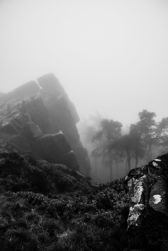
From the moment I stepped onto the path, the mist had already settled in—thick, heavy, and all-consuming. The kind that doesn’t just sit in the distance, but surrounds you completely. The horizon vanished almost instantly, replaced by a soft, shifting wall of grey that turned the familiar into something far more uncertain.

And that’s where the magic started.


🪨 A Landscape Rewritten

Whispers of Green

The Roaches are known for their dramatic gritstone formations—bold, jagged, and imposing. But in the mist, those same formations lose their scale. They appear suddenly, looming out of nowhere, then fade just as quickly back into the haze.

It changes how you experience the place.

Without long views to guide you, your attention is pulled inward. Every step becomes more deliberate. You notice the texture of the rock underfoot, the way water darkens the stone, the subtle shifts in light as it filters through the fog.

The landscape isn’t gone—it’s just quieter.


🌲 Into the Woodland

After the Rain

Dropping down from the ridge into the trees, the atmosphere shifted again.

The woodland felt enclosed, almost protective. Twisted pines stretched upward into a pale sky, their shapes softened and blurred by the mist. Some frames naturally fell into monochrome here—contrast and silhouette telling the story better than colour ever could.

Other moments held onto just enough colour to remind you the world was still there beneath it all. Greens muted but present. Browns deepened by moisture. Everything slightly subdued, but richer for it.

There was very little sound. No wind. No distant voices. Just the damp ground underfoot and the occasional drip of water from branch to branch.

It’s the kind of quiet that makes you slow down without even realising it.


👣 The Path Forward

Lone Walker

One of the most striking things about walking in these conditions is how the path behaves.

It doesn’t lead you toward a destination you can see. It simply disappears ahead, inviting you to follow without knowing what’s coming next. Footprints fade quickly. Landmarks lose their meaning. Even the sense of distance becomes distorted.

At one point, a lone figure appeared ahead—just a silhouette against the mist, moving steadily upward along the stone path. Within moments, they were gone again.

It was a simple moment, but it captured the feeling of the entire walk: fleeting, quiet, and slightly surreal.


🌫️ A Different Kind of Roaches

Forest of Silence

This wasn’t about dramatic views or sweeping vistas.

It was about mood. Atmosphere. Presence.

The Roaches in mist strip everything back to its essentials—shape, texture, light, and feeling. It’s a reminder that sometimes the best conditions aren’t the clearest ones, but the ones that force you to see differently.

To slow down.

To look closer.

To feel the place rather than just observe it.


📷 Behind the Images

  • Location: The Roaches, Staffordshire Moorlands
  • Conditions: Heavy fog / low visibility
  • Focus: Atmosphere, texture, and minimal composition
  • Style: Mixed monochrome and muted colour grading

Small Kingsley Loop — Woodland Edges, Valley Views & Quiet Moorland Charm

This gentle 5.5km circular walk begins on the edge of Kingsley, a hillside village set in the heart of the Staffordshire Moorlands, overlooking the dramatic sweep of the Churnet Valley. Kingsley’s roots stretch deep — recorded in the Domesday Book and once part of a landscape shaped by medieval agriculture, later thriving through Potteries-era mills, railway trade, and local quarries feeding the Stoke iron and ceramics industries.

You set off along quiet village lanes before the world softens into open meadow edges and farmland trails. The path curves gently with sweeping views down toward the Churnet — once a key transport corridor linking the Potteries to the wider world. Though peaceful today, the valley was once alive with canal barges and steam trains, carrying clay, coal, and finished ware.

Soon the route leads into light woodland and hedge-lined tracks, where moss-covered stone walls hint at centuries-old field boundaries. Here, the countryside breathes slowly; kestrels drift above pasture and the calls of rooks echo across the hillsides.

Re-emerging into open country, you follow undulating ground with rolling hills and patchwork fields meeting the sky. On damp days, the earthy scent of wet leaves fills the air and the hedgerows shine with water beads catching the light — moments of quiet beauty that reward patient walkers.

The loop returns gently to Kingsley, with roofs and steeple rising through autumn foliage. It’s an unhurried walk — a short journey that gives you space, sky, and the hum of rural life lingering unchanged by time.

Walk Summary — Small Kingsley Loop

Distance: ~5.5 km / 3.4 miles
Elevation Gain: ~95–120m
Duration: 1.5 – 2 hours (relaxed pace)
Difficulty: Easy
Route Type: Circular

Start Point: Kingsley village, Staffordshire Moorlands
Terrain: Village lanes, farm tracks, field edges, light woodland paths
Best Time to Walk: Dawn or golden hour for best light; stunning in spring and autumn
Footwear: Walking shoes/boots recommended (paths may be muddy after rain)
Dog Friendly: Yes — keep dogs on a lead near livestock
Parking: On-street parking in Kingsley (please be mindful of residents)
Navigation: Straightforward — OS map recommended for confidence


DSC_1013
DSC_1047
DSC_1007
DSC_1044
DSC_1008
DSC_0998